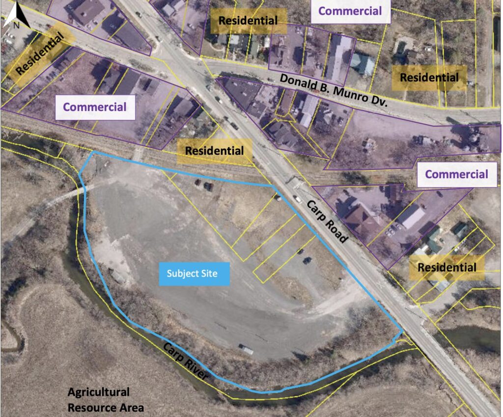
The City of Ottawa has posted a development application for the old Karson facility at 3711-3725 Carp Road beside the Carp River and behind the post office. You can find the application and supporting documents here: Application # D07-16-23-0008.
Friends of the Carp River reviewed the application documents, particularly the Planning Rationale and Design Brief, Environmental Site Assessment, Environmental Impact Statement, and Draft Plan of Subdivision.
Brief overview of the proposed development.
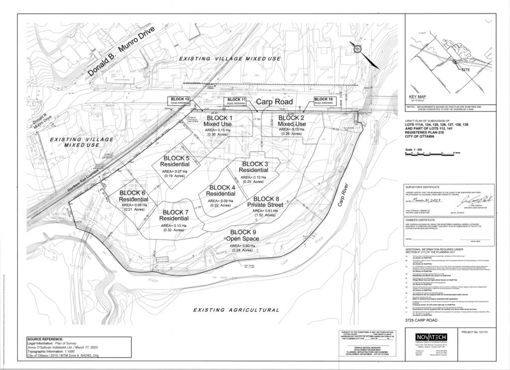
The development consists of two mixed use blocks on Carp Road with commercial space on the ground floor and two floors of nine residential units above. There are five blocks of stacked residential dwellings with twelve units each. Total residential space is 78 units.
The development is adjacent to the Carp River and its floodplain. A 30 meter vegetated buffer is maintained between the river and the parking lot. Some of the parking spaces lie within the 100 year flood line.
Our comments.
We submitted our comments to the City and to Councillor Kelly.
Friends of the Carp River welcome the development of this property. This is an opportunity to remove an eyesore from the entrance to the village, remediate contaminated land, add medium density housing to Carp, and showcase the Carp River with a pathway along the buffer strip that will be improved with native plants.
We have three comments on the application.
1. The creation of a pathway in the floodplain’s 30m buffer area must be part of the project.
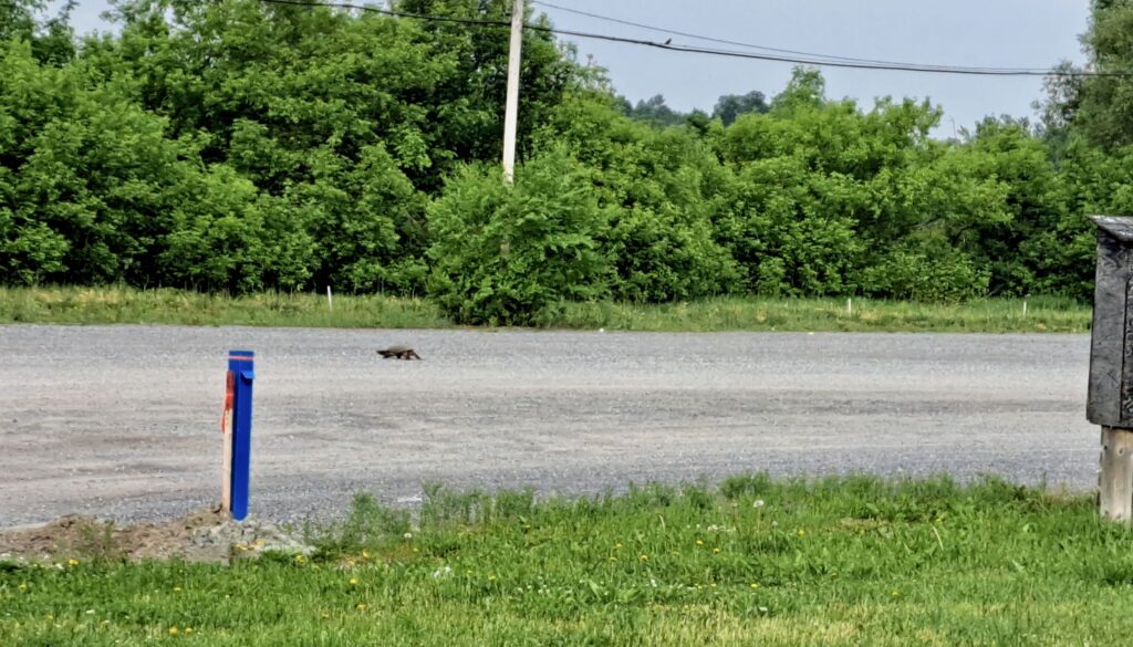
2. The site is nesting habitat for Snapping turtles. Suitable nest area(s) must be constructed to replace the nesting area being lost.
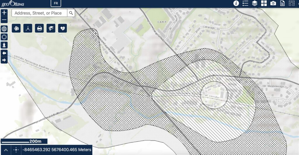
3. The site lies within Source Water Protection Area: Well Head Protection Area C for the village of Carp. Care must be taken with how the site’s contamination is dealt with during construction.
1. Construct a pathway along the river.
The City must require a community pathway along the river as part of site plan approval.
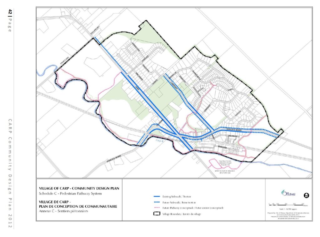
As the application notes, a pathway along the river at this site is included in the 2012 Carp Community Design Plan, but for some reason the application has punted its creation to some indefinite future action.
The best (and cheapest) time to construct such a pathway is when there is equipment on the site and when the buffer area is being remediated with native plantings as per the Environmental Impact Statement.
Other arguments include supporting the city’s new Official Plan, particularly under Healthy and Inclusive Communities.
We also strongly support the Environmental Impact Statement’s recommendations for native plantings in the buffer area.
2. Add turtle nesting sites.
As part of the buffer strip improvement, two or three turtle nesting sites should be created.
Another local organization, Friends of the Carp Hills, ran a turtle conservation project in Carp this year with support from the Canadian Wildlife Federation. The edge of the parking lot is heavily used by Snapping turtles from the Carp River for laying eggs. Predated nests adjacent to the river are easy to find.
The Common Snapping Turtle is a Species at Risk, Special Concern.
3. Site contamination must be carefully remediated.
The Phase 1 Environmental Site Assessment describes the contamination of the site from its previous use as a garage and fuel storage area.
The site lies within Source Water Protection Area: Well Head Protection Area C for the village of Carp (see Figure 1).
Given the site’s soil contamination, care must be taken to protect both the river and Carp’s municipal well head in the village during construction.

