
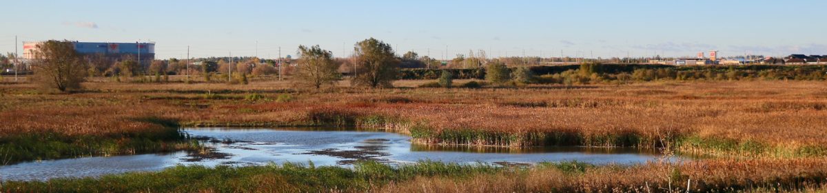
The Carp River Restoration Project (2016-2018) has utterly transformed a four kilometer section of the Carp River in Kanata from a straight, shallow, silt-filled channel into a healthy wetland and riverine ecosystem — much like what the Carp River would have been many decades ago. In addition to restoring the river’s meanders and rehabilitating adjacent wetlands, the project planted thousands of native trees and shrubs, and seeded the floodplain with flowers and grasses to provide a welcoming, biodiverse habitat for wildlife.

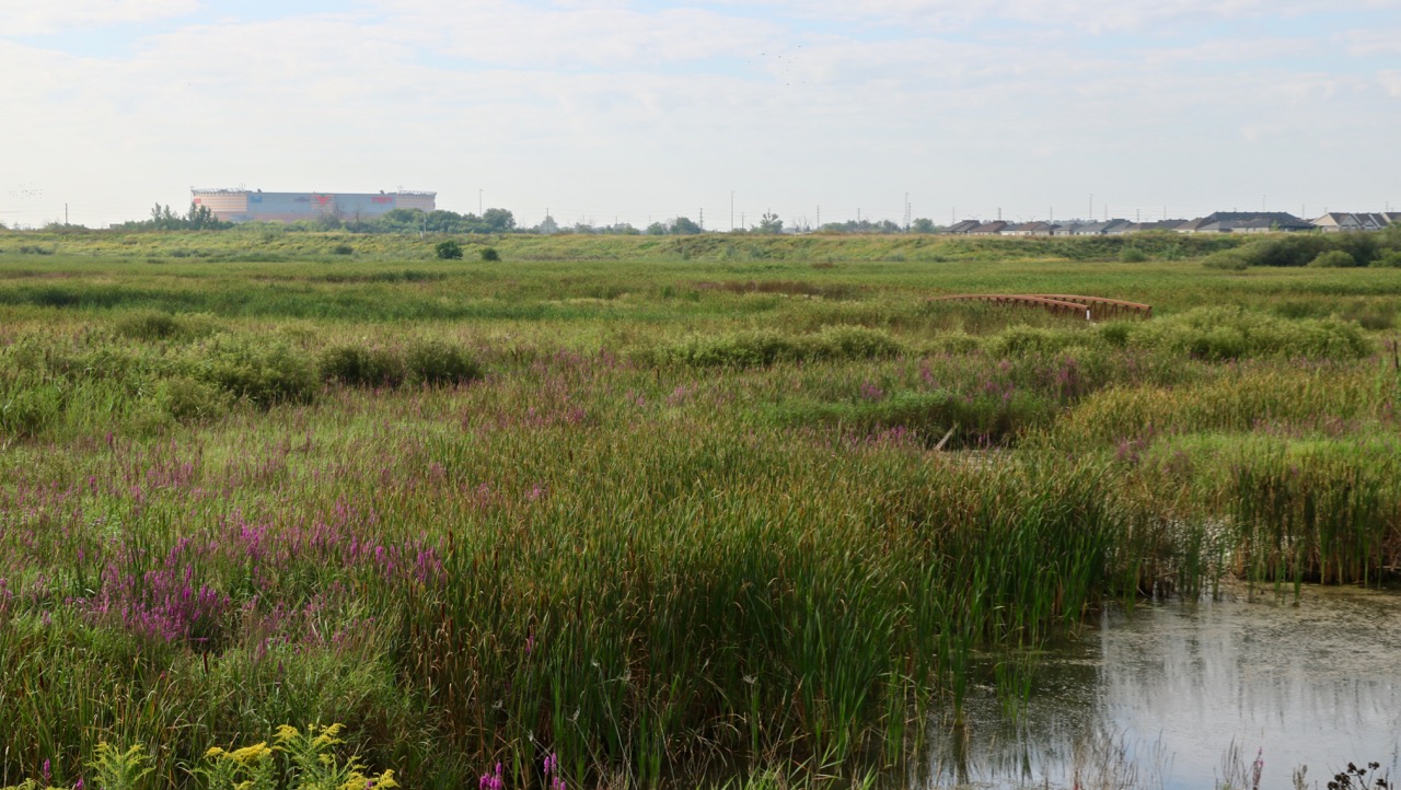
In the early 1900s the Carp River was dredged, straightened, and widened in an effort to reduce flood damage, drain fields, and improve flow. However, a lack of erosion control caused heavy silting which eventually reduced flow and promoted flooding. The recent restoration project narrows the channel and restores its meanders, which increases the diversity of aquatic habitats.

The project was initiated by developers in order to allow housing (Arcadia) and commercial development in and near the floodplain. Reduction in floodplain area was compensated for by improving water absorption and storage, with the end objective being no net increase or decrease in peak flows from pre-restoration levels at the downstream end at Richardson Side Road. In addition to upstream inflow from Glen Cairn, the area also takes in overflow from storm water ponds on the north side of Terry Fox Drive.
EcoServices

The restored river and its wetlands are an excellent example of how natural areas can co-exist in suburban settings, providing recreation and ecoservices for adjacent and downstream communities:

- protecting water quality
- mitigating flooding
- controlling erosion and reducing sedimentation
- providing groundwater recharge and discharge
- providing habitat for fish and wildlife
- sequestering carbon
- capturing storm water
- providing paths for walking and cycling
Carp River Conservation Area
 The Carp River Conservation Area is the two kilometer section of the restoration site that lies between Richardson Side Road and the Queensway (Highway 417). The Mississippi Valley Conservation Authority is developing the Carp River Living Classroom, which will animate the river and its wetlands for education and discovery. The Living Classroom will be a destination for families to learn about biodiversity and for hands-on learning by thousands of students from nearby schools.
Learn More
See our Walking page for information on how to explore and enjoy the restoration area.
See our Birding page for eBird hotspots at this area.
Discover the Carp River Living Classroom at the Carp River Conservation Area.
Want to contribute to our knowledge about the river? Become a Citizen Scientist.
Read our commentary on the project from 2011: Kanata West Development.
An independent web site dedicated to the restoration provides detailed information: Upper Carp Wetland
